Trip Report: The Royal Arch Route

The Plan
A few weeks ago, I was looking over my friend's shoulder as he studied a topo map on his computer, and mostly out of curiosity, I asked him what he was looking at. He began to tell me about the Royal Arch Route, a hiking/canyoneering route in the Western part of the Grand Canyon that he had been invited to join a group on. He didn't know anyone on the hike but was going anyways. Much to my surprise, he asked me if I wanted to join, as there was an extra spot on the permit. I've lived in Northern Arizona for a year now. Despite multiple trips to the canyon, I had yet to do an overnight in it and was itching. What an opportunity!
Over the next few weeks, the plan came together, and after a few others dropped out of the trip, it ended up just being my friend, myself, and the guy who planned the trip who neither of us had ever met. I couldn't have been more excited about the adventure.
The main Royal Arch Route starts at the South Bass Trailhead, follows a trail down to Royal Arch Creek, and follows that all the way to Royal Arch. From there, there are two options. Follow the canyon all the way to the river, including two 150 foot+ rappels. Or hike back a mile onto the Tonto Platform, and take that down to the river. This option only includes about a 20-foot rappel and would be our choice as it requires carrying much less rope. From the river, groups can take a side hike back to see Elve's Chasm, then climb back to the Tonto Trail, take it to Bass Beach, and follow the South Bass Trail back to the trailhead.
Things would be a little different for us, though. First of all, the Havasupai Reservation is still closed to vehicle traffic, so driving the final seven miles of road to the South Bass Trailhead is not an option. We would leave our car at the Tribal Boundary, but we'd be taking a different way down rather than hike to the trailhead. Point Huitzil, a few miles west along the rim from South Bass Trailhead, offers brave hikers a chance to drop into the canyon on an unofficial route. This route has been used for hundreds of years, first by Hopi and other Puebloan Native Americans. It involves some risky down-climbing and can be challenging to find if one cannot locate an important "rabbit hole," which lowers down through a small hole in a massive boulder.
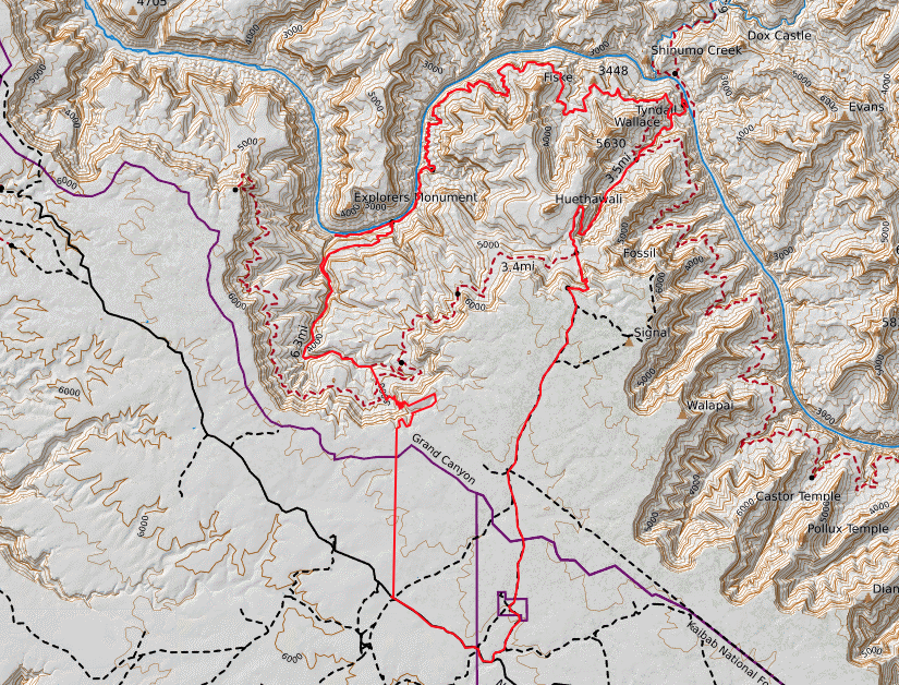
A map of the exact route we took, including the Point Huitzil alternate. The “official” Royal Arch Route starts at the South Bass Trailhead and follows the trail Southwest to where we met up with it coming down from Point Huitzil.
Day 0
My friend and I planned on him meeting me at my house in Flagstaff around 3 PM, from which we would head up to the main area of the park to meet up with our trip leader around 4. He didn't end up getting to my house until 4:30, which I was okay with as it gave me time to finish watching a basketball game and eat a good, late lunch before heading up. Besides, I wasn't too attached to getting any of the initial road walk done that night, figuring we had plenty of time to get it done in the morning. We finally got to the park and met with the other guy around 5:30, and all piled into my car and headed off towards the Tribal Boundary. I have removed the passenger seats in my Toyota Rav4 to make room for a bed in the back; my buddy squeezed back there for the entire hour and a half, dirt road drive out.
That evening we parked the car just as the sun was going down. A few miles south of the rim, there were no spectacular views of the canyon that evening, just the classic Northern Arizona Pine/Juniper forest to walk through until a suitable camp was found. Rain clouds seemed somewhat threatening, but I took the risk and cowboy camped, feeling too lazy to set up my tent. It paid off, and the clouds made way for a bright, starry night. It was cold, but I knew the next few would be boiling, so I tried to savor the evening chill.
Day 1
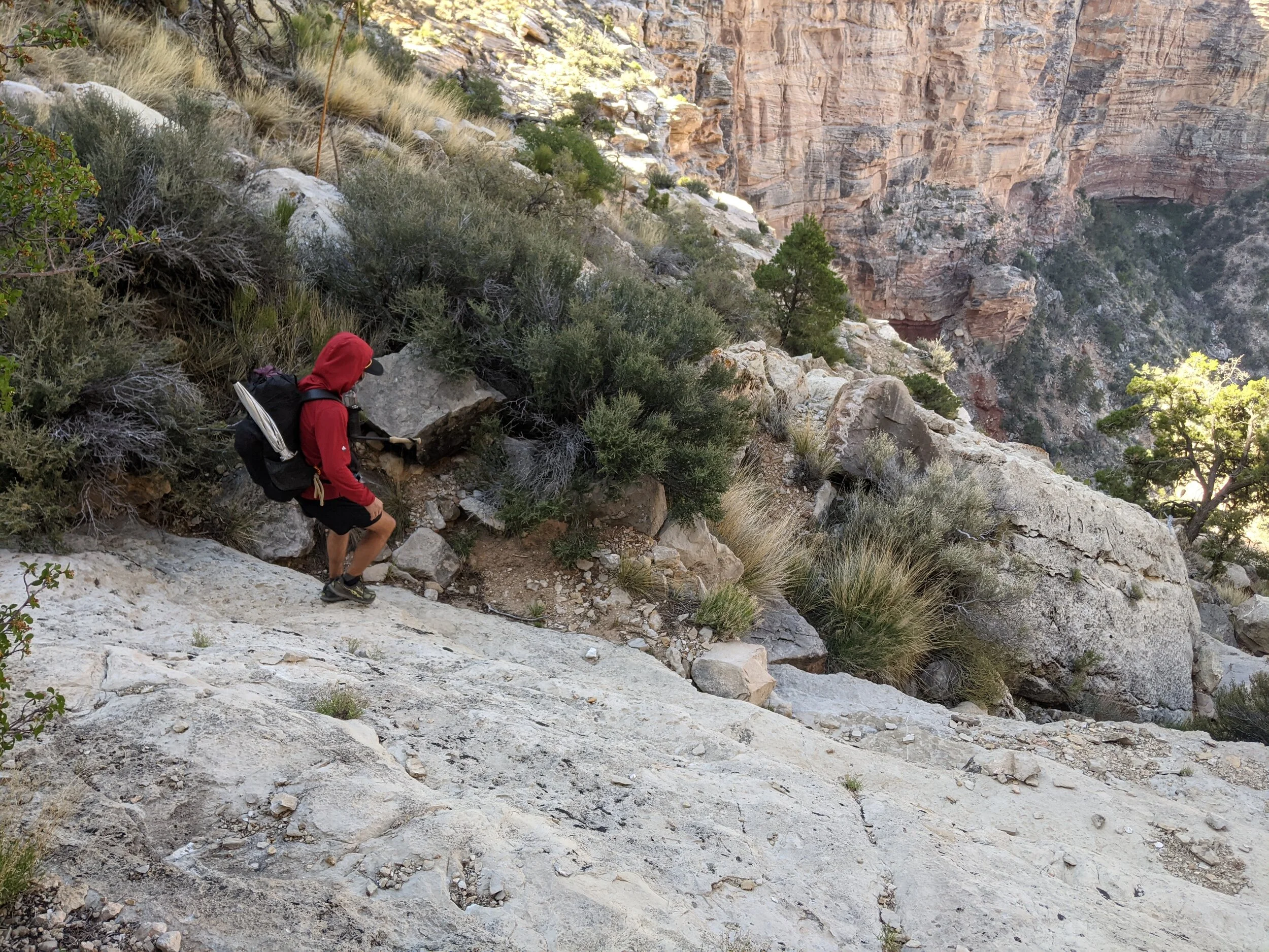
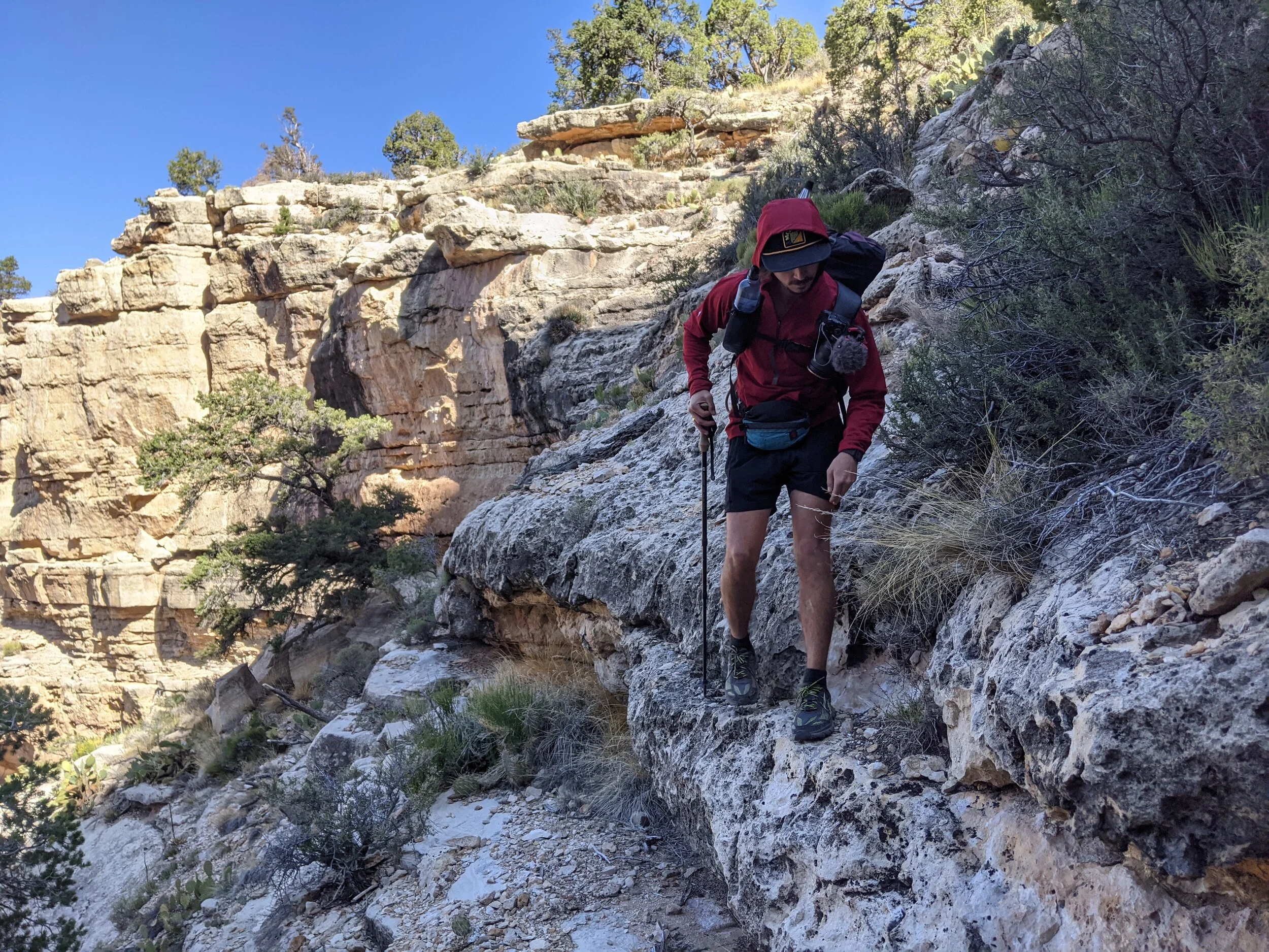
We all woke up around 6 AM, eager to head towards the rim in search of the route down via Point Huitzil. Even though the 4ish miles to the rim were just cross country, they were pretty easy. It's all flat up there, and a bit of brush was all that we had to navigate through to reach the rim. Once there, we were still about half a mile West of where we could expect to start finding the way down. That half a mile turned into more of a mile as we had to hike south and around some significant drainages that started flowing into the canyon.

Scouting out the initial route down from Point Huitzil. Note the sheer drop off all the way around the rim.
As we made our way back down to the rim for the last time before actually dropping in, the sheer insanity of walking into the Grand Canyon dawned on me. Multiple 200 foot+ walls drop straight down at a sharp vertical as you look down. To look upon it and think that there is any possibility of actually walking down feels ludicrous. This thought only made me more exciting though. I imagined the bravery of the earliest humans to decide to walk down into this massive ditch - no beta or routes or GPS to follow - only trial and error. Walk down as far as you can; if you reach a cliff, turn around and find another way.
Taking on the steep slabs involved in the route down.
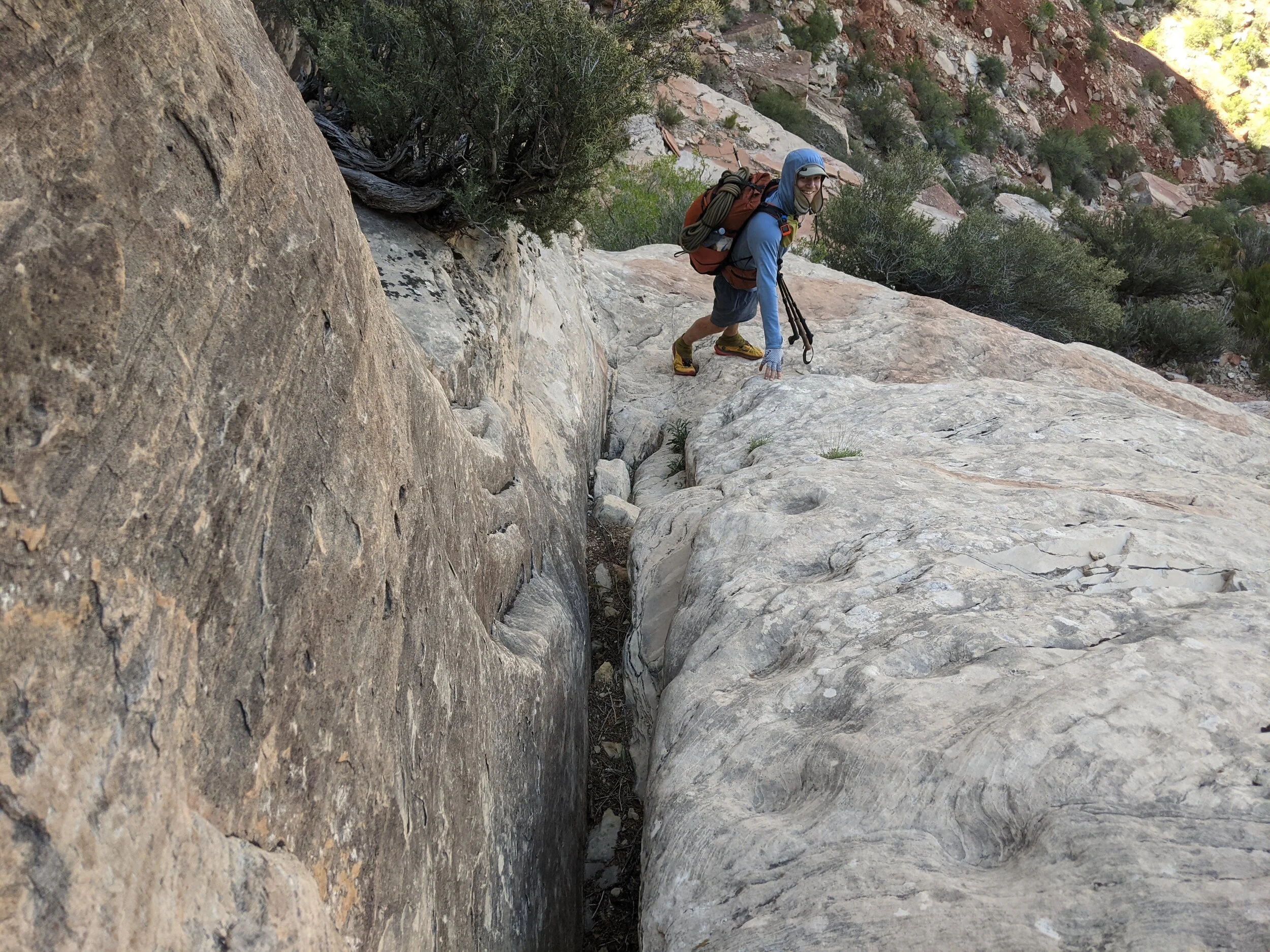
There was often little to no depth to walk on.
The main drainage down past Point Huitzil had cairns as I suspected it would. Once we dropped down into the canyon, I was shocked to consistently see them down the steepest of slopes. A lot of tricky, slippery down climbs were required right off the bat. This, of course, would only be the beginning. We'd occasionally reach a point where we couldn't find the next cairn and simply had to follow intuition. Which way down seems the most logical? Which path seems the least likely to lead us to a cliff?
A good, clear photograph of the centuries-old Hopi Steps. Note the faded divers in the slabs of rock.
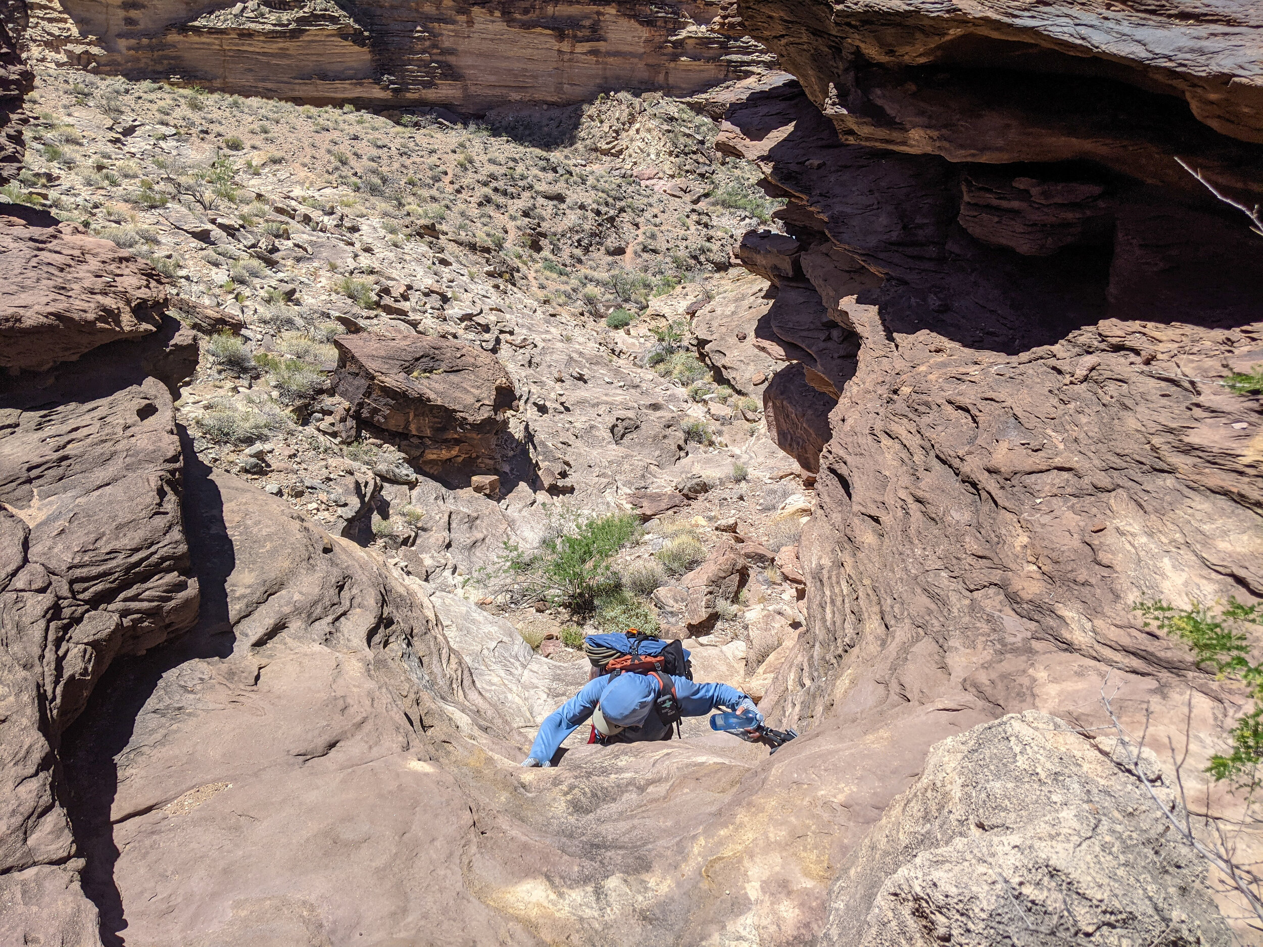
Eventually, we found the slabs section, where the famous Hopi Steps could be found. Literally, walking in the footprints of humans some 800 years old gave a unique feel to the trip. This was not the South Kaibab Trail. This was finding your way down to the canyon by any means necessary. The rock slabs grew wide and steep. Fortunately, the Slickrock wasn't too slippery, and I could usually walk down without needing to grab onto anything. I'd occasionally drop to my butt to safely slide some sketchier sections. Some actual downclimbing started popping up. We came out to a cliff in the rock, but the cairns had lead us right there. As we looked around brainstorming, it became apparent that we were likely near the entrance of the "rabbit hole" and would need to find it.
Only a few minutes of looking around lead us to a hole in the rock, big enough to drop down with pack still on. That hole leads down to a wider opening, which dropped down a sheer 10 feet or so to the exit hole underneath the building-sized boulder we were crawling through. An old, worn log sat propped directly on that wall, obviously placed intended to downclimb. This was without a doubt the rabbit hole, the log set there perhaps hundreds of years ago. The climb itself was actually less tricky than some of the earlier downclimbs we had done. It helped that a fall on this would only result in a 10-foot drop - not hundreds. The head game was easier. There was a good ledge on the opposite wall to push into as one guided their feet down the short stumps of the log. After passing packs down and going down one-by-one, we were all through the rabbit hole within a few minutes.
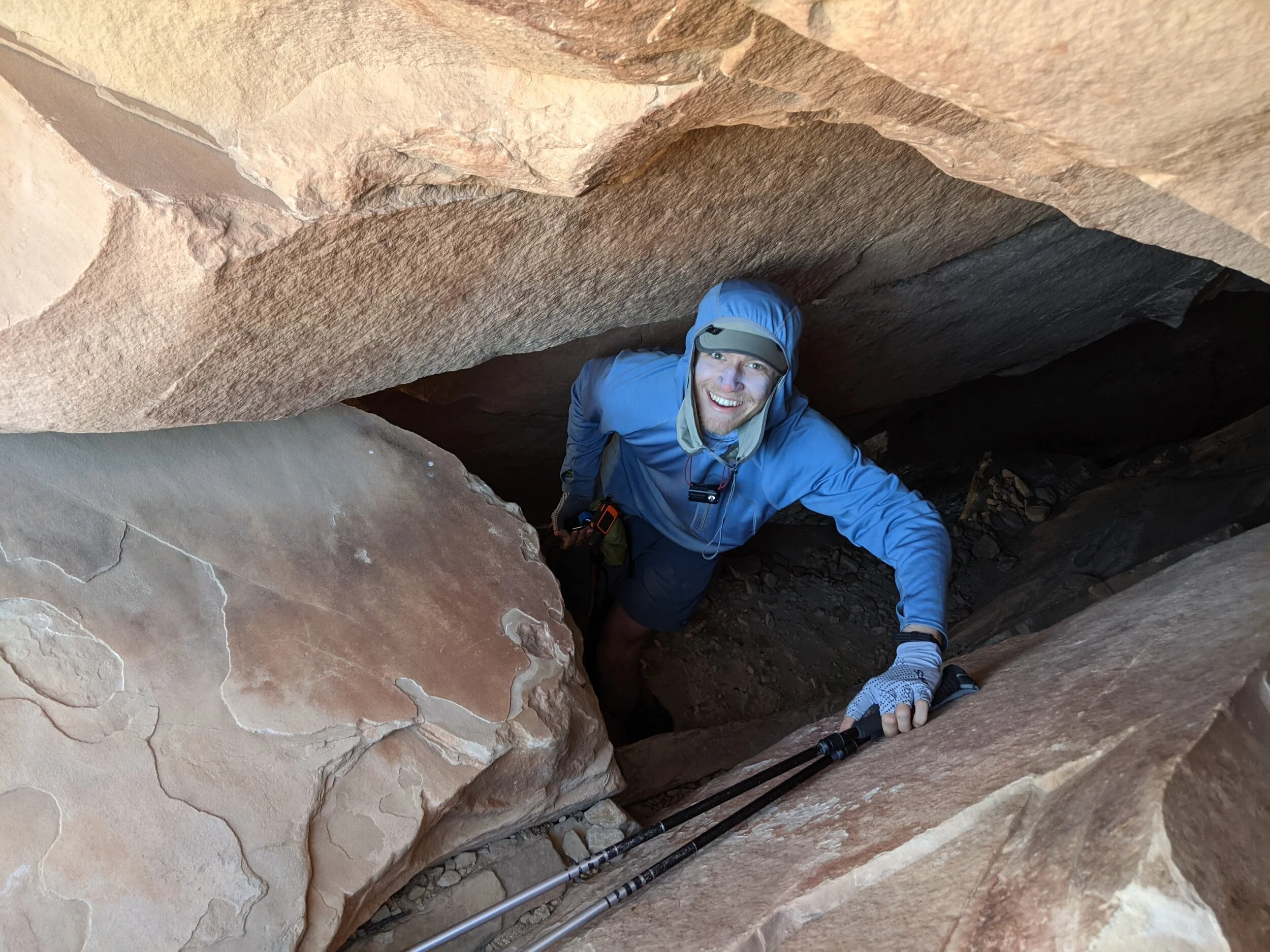
Looking down on our trip leader in the first “room” of the Rabbit Hole…

…he prepares to drop down…

…the ten foot down climb on a surprisingly sturdy log…

…my buddy making sure to some good video before the climb down…

…a few feet further towards the River!
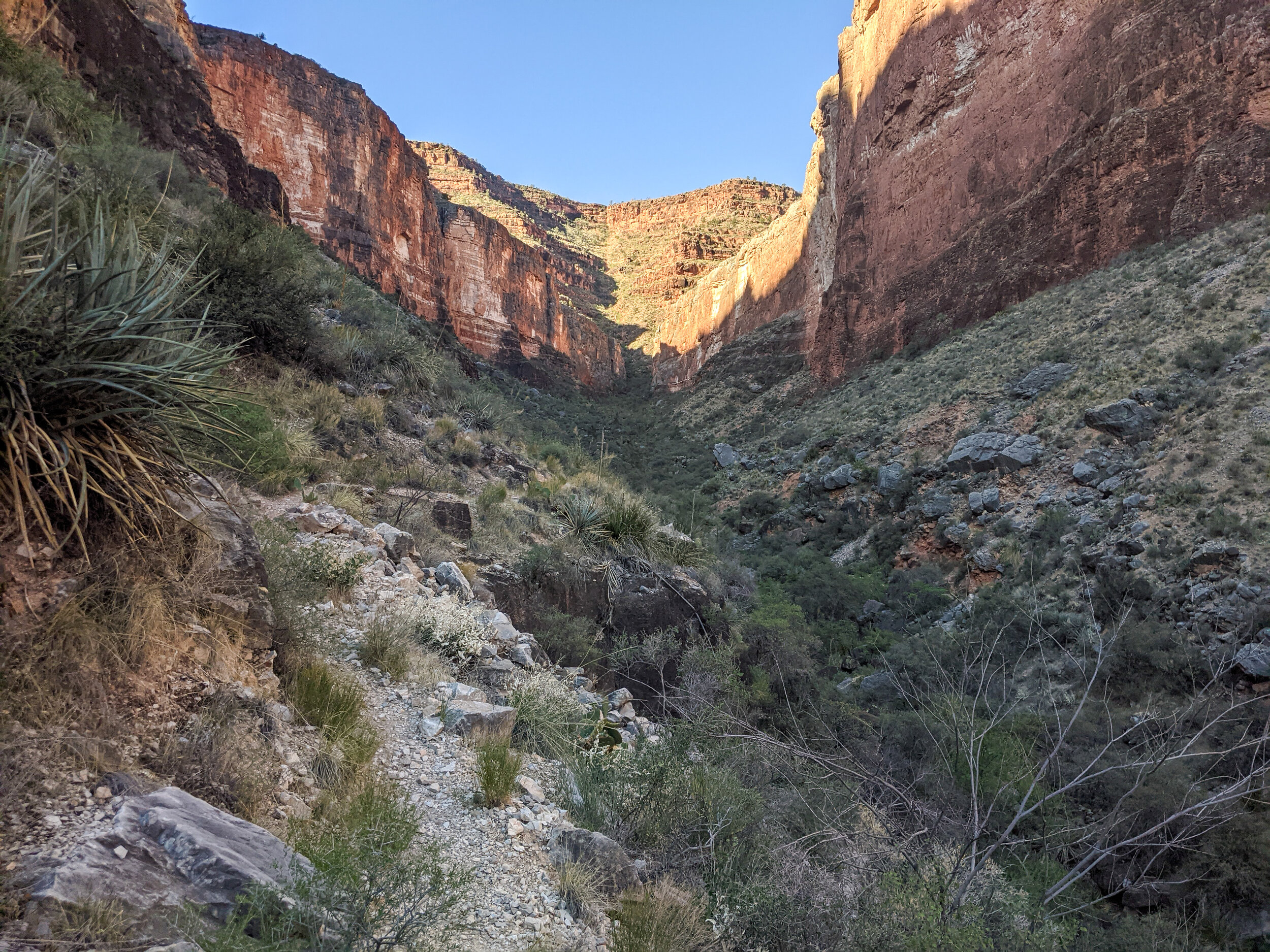
Views of the canyon quickly changed as we emerged from the boulder, realizing how much elevation we had lost. Looking at the sheer wall opposite the canyon, we realized we were almost past that first, seemingly impossible descent. After a short break in the shade, we dropped the remaining distance on that section and began a downhill hike into the Royal Arch Creek Canyon, where we'd be spending most of the day.
Now officially on route, we begin the descent down Royal Arch Canyon.

One of the many drop offs in the main canyon basin requiring a walk-around.
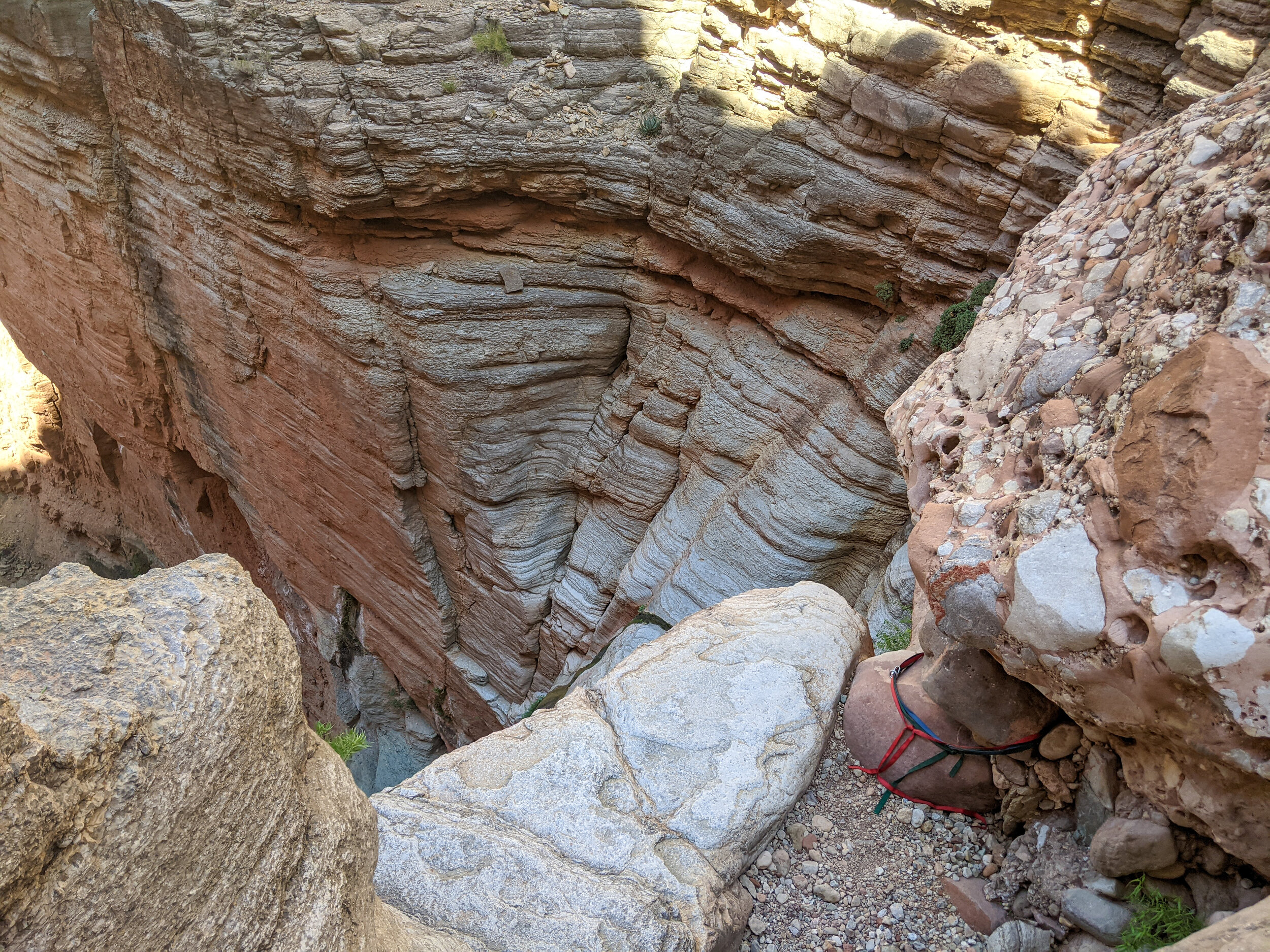
The canyon would widen and tighten back and forth, sometimes offering steep drop-offs on the slick rock bottom that required walkarounds. Now on the official Royal Arch Route, the trail was much easier to follow. Still, we weren't out of the woods by any means when it came to the technical sections we'd need to traverse to eventually reach the Colorado River. Before we finally reached an area where it opened up to a vast, hundred-plus foot drop off, some more in-canyon downclimbing was required. We followed some cairns up the canyon wall to the right, where we took a break and looked back at the wall to the left.
It was instantly recognizable from photographs we had seen before leaving for the trip. This was perhaps the most infamous part of this route, "The Ledge of Death." The cairns clearly lead up onto that wall as well, inching along the ledge as it got smaller and smaller, eventually leading to a section that didn't seem to have any depth to walk on at all. We sat and debated continuing on the side of the canyon we were already on - which certainly had an easier, less dealy way down - or heading back around and across to check the ledge out. Our trip leader and I walked over while my friend stayed back to photograph us.

The “Ledge of Death”. No, your eyes don’t deceive you. The trail traverses along this wall.
As we approached the ledge, I could feel myself getting psyched up. We reached the part that required the first, real technical move. Strong handholds hovered over a wide gap in the footholds. One would have to simply hold on while extending their right leg about four feet over a 60-foot drop. We stood there and looked at it for a few minutes. Not feeling 100% confident in my own bouldering abilities, I turned back to take the safer route around while my compatriot pushed forward. My friend decided to take the ledge as well. As I walked back down into the canyon on my safer route, I had a perfect vantage point to watch them traverse the nearly 100 feet of ledge navigation, all filled with dangerous moves. It was fascinating, horrifying, and thrilling to watch. We all made it down into the main canyon again safely and happy to move on from the section.

My friend bravely traversing the ledge. Excuse the poor photo quality, which comes from a screen grab of a video I took on my phone.
After one more shaded break (it was getting hot!), we finally pushed down the extra mile past the trail turnoff to get to the Royal Arch. It indeed was an oasis in this barren canyon. Cascading, clear water flowed through the orange and gold arch in a lush, riparian area. We walked past it a few more hundred feet to find all the webbing loops and rappelling equipment for the first big rappel, for which we weren't carrying the right equipment. This is where we would turn around and head back to the main route. First, though, a nice, relaxing break under the arch. We sat with our feet in the cold water, hydrated, laughed, ate snacks, and enjoyed the serenity that came along with just how isolated we were.
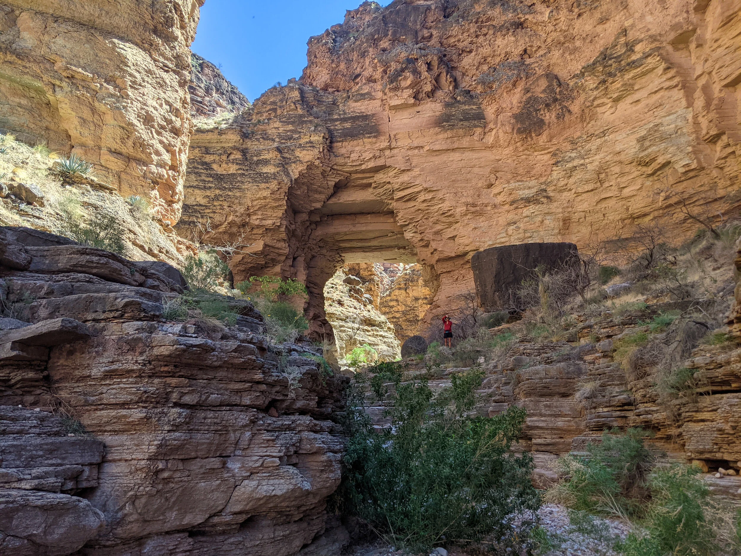
Finally, the Royal Arch!
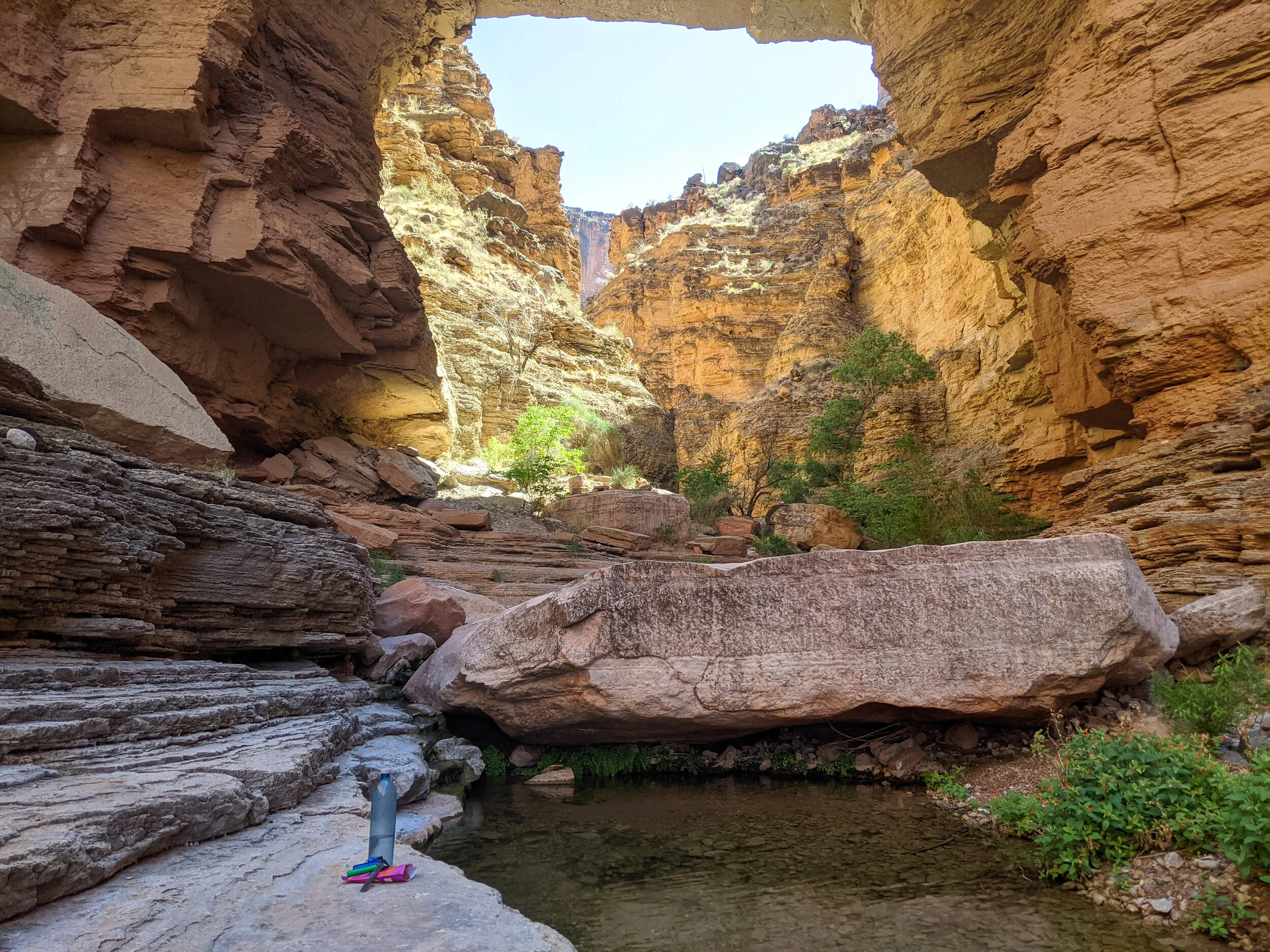
The scene of our much needed shade/water break, right under the Arch.
The site of the first big rappel, and the end of our trip down Royal Arch Canyon.
By the time we got back up to the main route, which climbed up out of the canyon basin and followed its cliffs along to the Tonto Platform, the afternoon heat had begun to descend from its apex, much to our relief. We shortly reached the final descent down to the river, views of its turquoise-blue water a few hundred feet below us. This is where our rappel came into play, about a 20-foot drop. We came across a rather ugly scene at the top of the rappel. Three ropes and eight webbing loops weres strewn all over the place. Some of them seemed to be years old. Despite it being absolutely clear on the permit, "pack out any old canyoneering gear and leave only the minimum amount necessary to safely descend," the parties before us clearly had not done this.

Look at all that extra rope and webbing! Remember folks, pack it in, pack it out applies to EVERYTHING. Even climbing gear.
This is a good point to pause and remind anyone who intends to do anything in the backcountry should be fully aware of and ready to abide by the seven principles of Leave No Trace! You can find them here. As reluctant as we were to add so much weight to our packs, we all knew the right thing to do would be to clean up everyone else's mess. After a few minutes of cutting webbing loops, pulling up ropes, and coiling everything up, we set up our own rappel with a few pounds extra on each of our backs.
Our 20-foot rappel, and our trip leader getting ready to drop down it.
The rappel itself was very straightforward, and it only took a few minutes for all three of us to actually get down. We pulled our rope down behind us and hiked on the river just ahead! We saw another group of three making camp right at Toltec Beach, so we hiked down the trail towards Elve's Chasm (our first destination for the next day) until we found a second beach on which we could camp. I laid my head on the banks of the Colorado that night. The stars were even brighter than on the rim. It felt like the rest of the world didn't even exist.
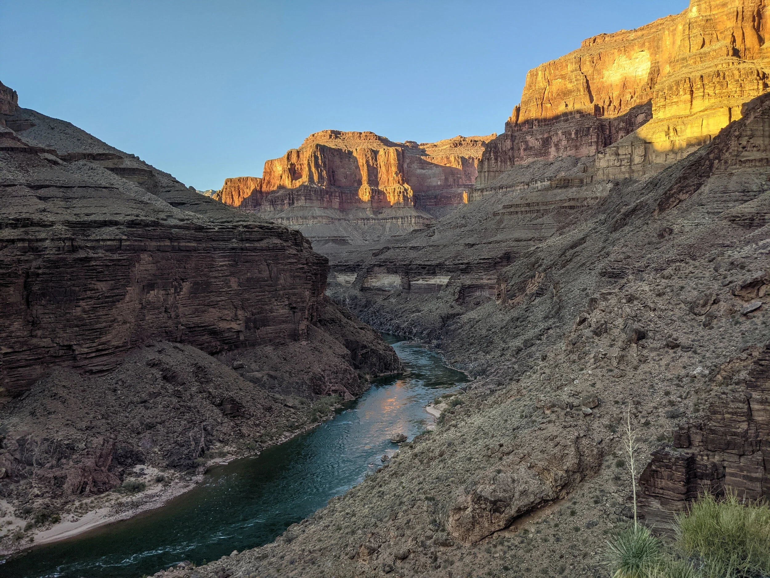
After a long walk down, finally the River in sight!

Not a bad spot to sleep for the evening.
Day 2
We actually rose a little later this morning than the last, which would prove to haunt us later in the day. More on that later. The morning was beautiful. It was fascinating to see how different the bottom of the canyon looked in the early morning light than it had the evening before. The sun, though, pretty, for now, was rising quickly.
It was only about a mile along the river to get to Elve's Chasm, but the steep ups and downs often required climbing, and it took us a good 40 minutes to get there. That alone was enough time to heat up, even doing the side hike without our packs which he had stashed by the beach we camped at. Elve's Chasm was worth it, though. Our second oasis of the trip and the culmination of Royal Arch Creek. In another lush riparian area fed by a waterfall, this crystal pool was perfectly shaded and an excellent spot to enjoy ourselves for a bit. I wish we could have stayed for longer, but the day demanded we got back to hiking.

Elve’s Chasm - the star of the entire route - and certainly worth the extra 2.4 miles. Next time I’ll just rappel straight to it!
When we got back to Toltec Beach, we were already sweltering. We all took a dip in the Colorado, and it felt great, then sat on the beach and had a snack for another 20 minutes or so. I think this break really did us in. We didn't get started on the long, hot, exposed, waterless stretch to Bass Beach until almost 11 AM. A poor decision in hindsight!
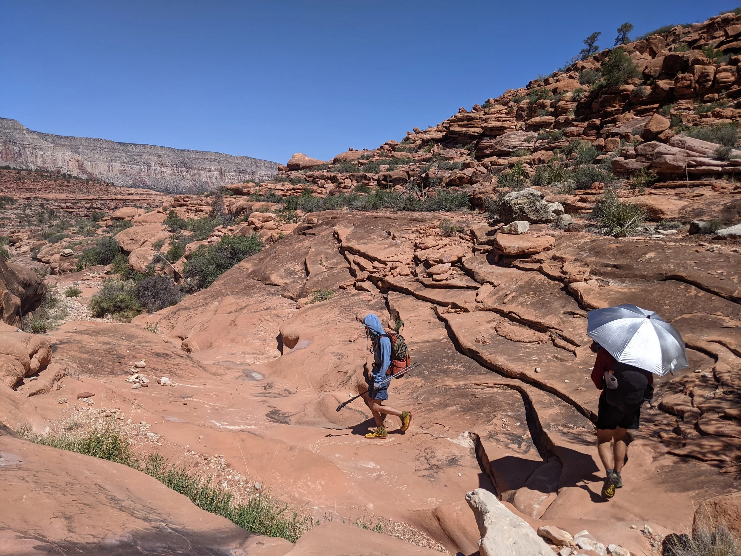
With a full five liters in my pack, I began to trudge along the river, slowly winding in and out of canyons, then finally climbing back up to the Tonto Platform out of Garnett Canyon. By then, it was beyond hot, and we knew we needed to escape it. Coming around the Western Wall of the next canyon, we took shelter under a ledge and tried to wait out the heat of the day. I nursed my water, which was getting harder and harder to fashion. Copper Canyon was only three miles away, but the water there was certainly not a guarantee. It still could be potentially six miles until we reached Bass Beach, our guaranteed river access that day.
Climbing up and out of Garnett Canyon…

…onto the Tonto Platform, which proved to be the hottest, most exhausting stretch of the entire trip.
The heat on the approach to Copper Canyon persisted, and we had to take a few more breaks before we got there. Much to our dismay, it was indeed dry. We reluctantly threw our packs back on, all tired, hot, and wanting to be done, and climbed back up to the Tonto to approach Bass Beach. I surprisingly found a second wind on this stretch, however, and cruised ahead, allowing myself a nice break at the turnoff for Bass Beach, where I waited for my fellow hikers.
We all practically stumbled the 1.7 miles steep downhill hike into Bass Canyon and down to the beach. It was nearly dark as we scrambled down the final rocky cliffs, but our timing could not have been more perfect. A massive raft became visible, floating and tied up to a boulder on the beach as we approached. We heard voices; there was a raft group there! We heard stories of hikers getting lucky and camping with raft groups, who often had much better food than the measly backpacking food we carried. This was the case this night, and the very kind group of rafters welcomed us with pork chops, egg rolls, salad, and even cheesecake. What a score!

Not a bad dinner for being at the bottom of the Grand Canyon!…
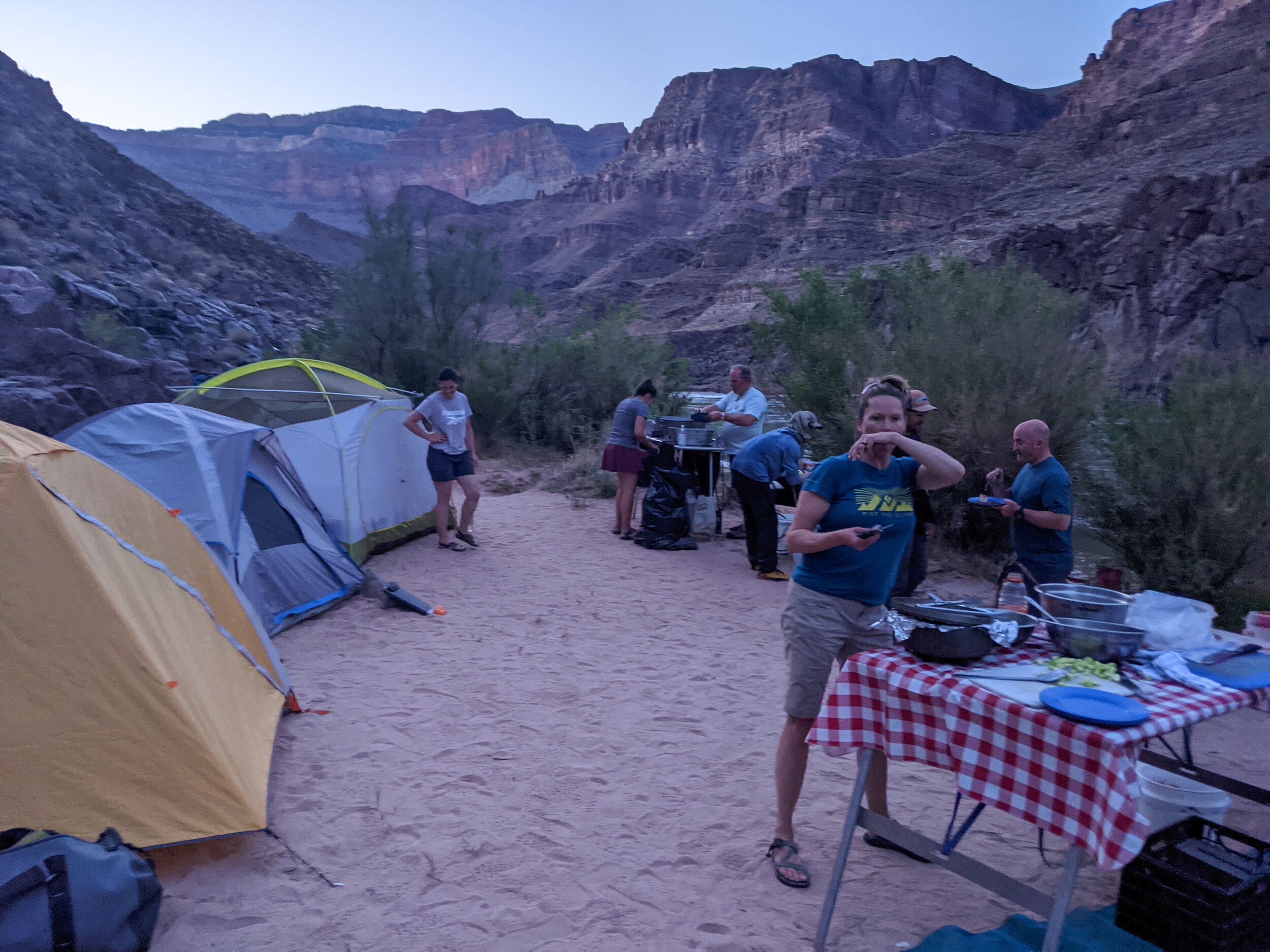
Provided by this delightfully friendly raft group.
That night I slept on the river again, completely stuffed, slowly sipping water as the evening went on, trying to rehydrate before the big climb out the next day.
Day 3

Filling up all the water we can before the long, steep climb up to the rim.
We all woke up an hour earlier, knowing we needed to get as much - if not all - of the 8 miles climb up to the rim done before the midday heat came. After filtering and filling our water to capacity, we began back up Bass canyon. Our trip leader wasn't feeling great, and it soon became apparent my friend, and I would need to monitor him the entire climb up as he was showing signs of heat exhaustion.
We were rewarded for the early start, as most of the steep climb up Bass Canyon was still in the shade as the sun had yet to rise over the East Wall. It wasn't until we emerged from the canyon and switched back up the wall of the Darwin Plateau that the sun found us. By then, we were nearing 5,000 feet of elevation. The difference in temperature from the bottom of the canyon was incredible.
The steep climb up out of Bass Canyon - it’s mouth visible in the center - was at least shaded almost the entire way.
Slowly the desert brush of the bottom of the canyon gave way to Junipers, red dirt, and massive patches of crypto soil. Thinking how much less traffic this part of the canyon saw than the main corridor in which I had done most of my exploring before, I realized just how different the ecology of that section must be because of human use. I felt sad and grateful at the same time to be in a part of the canyon that was perhaps a bit more as nature meant for it to be.
We took as many breaks as we needed for our leader to rest, slowly pushing across the Darwin Plateau and up the final climb to the rim. The South Bass Trail is without a doubt my favorite trail I've ever taken out of the canyon. The view at the top gave us a perfect vantage of the last four or so miles of hiking, all the way down to the mouth of Bass Canyon. A stunning end to an incredible hike. Having a vantage point of the canyon I'd never seen before was awesome.
We trudged the seven miles of dirt road back to the car, grateful to be on flat ground again, if not a little sad to have left the magic of the canyon.
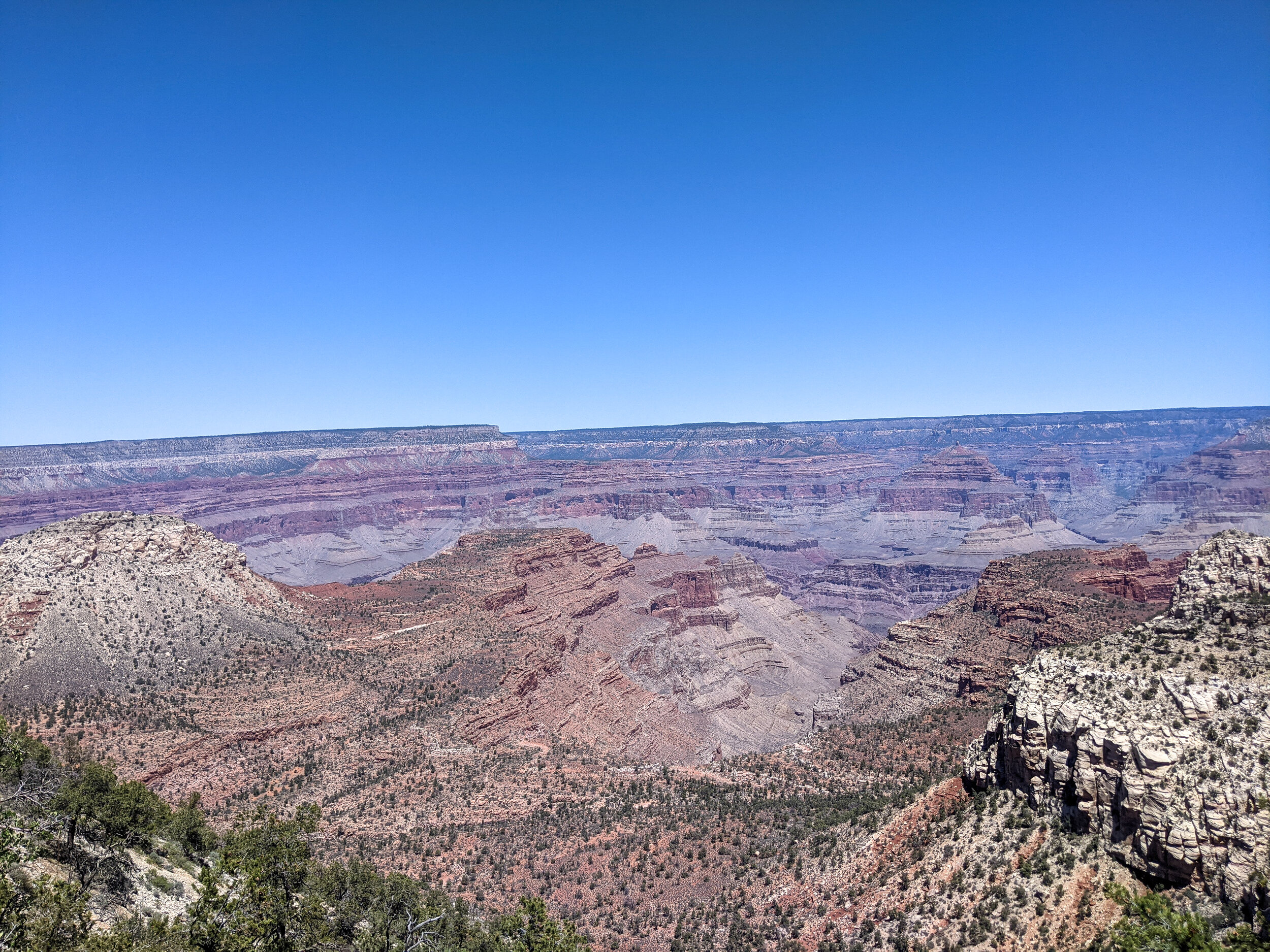
The final view of the canyon, with our route up Bass Canyon, onto the Darwin Plateau, and up to the rim all visible.
Thoughts Back Above Ground
This was one of my favorite backpacking trips I've ever been on. The canyon is special, and all-time spent in it is special. It truly feels like the rest of the world doesn't exist when one is down there. I have a few regrets from the trip, but they only involve wanting to do more if I were ever to do it again! I'd love to try the full canyoneering route down the Royal Arch Canyon, as well as dragging the trip out an extra day. I just want to spend more time down there!
Mostly, my takeaway from this trip is that I'm so excited to do more in the canyon. Living as close as I do to it, I have no excuse to not get down there for multiple overnights every year. How fun would a raft trip be? There are so many more off-corridor trails to explore as well. This trip was great, but I can't wait for more!
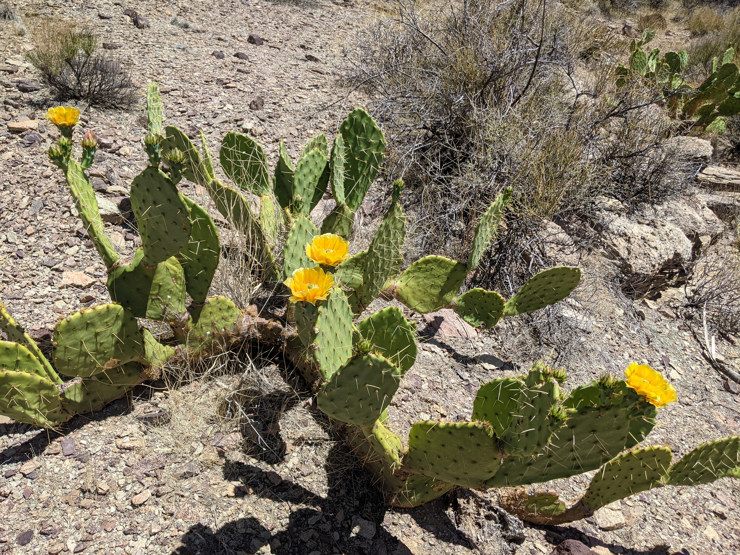
The cacti were all in bloom this time of year!

And look how healthy that Cryptosoil is!

Life can always be found in the Canyon.